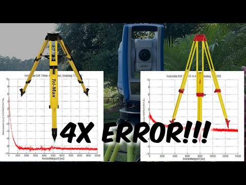
STAR*NET for Land Surveyors - Step by Step Guide with Hot Tips
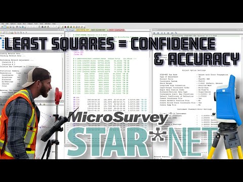
Learn how to use STAR*NET, the industry-leading least squares adjustment software for land surveyors. This comprehensive step-by-step guide covers: - Setting up a new project and customizing default templates - Configuring project options for optimal results - Importing and processing raw survey data - Understanding data codes and inline ...